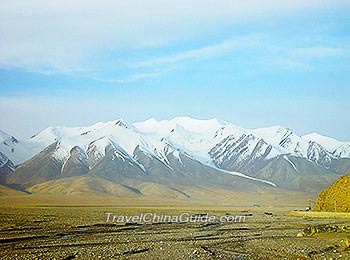
Kunlun Mountains
Kunlun Mountains Facts
![]() Location: situated in the junction of Xinjiang, Tibet and Qinghai; roughly parallel to Himalaya Mountains to the south and Tian Shan Mountains to the north
Location: situated in the junction of Xinjiang, Tibet and Qinghai; roughly parallel to Himalaya Mountains to the south and Tian Shan Mountains to the north![]() Total Length: 2,500 kilometers (1,553miles)
Total Length: 2,500 kilometers (1,553miles)![]() Average Elevation: 5,500-6,000 meters (18,045-19,685 ft).
Average Elevation: 5,500-6,000 meters (18,045-19,685 ft).![]() Average Width: 130-200 kilometers (81-124miles)
Average Width: 130-200 kilometers (81-124miles)![]() Highest Peak: Liushi Shan with the elevation of 7,167 meters (23,514 ft)
Highest Peak: Liushi Shan with the elevation of 7,167 meters (23,514 ft)
Kunlun Mountains Mystery
According to Chinese mythology and legend, Kunlun Mountain is the residence for Xiwangmu, the living-forever goddess in charge of marriage, fertility and who protects women. Xiwangmu has a human head and leopard’s body in mysterious tales. She is served by two blue birds.
Must-see Attractions of Kunlun Mountains

Golmud River (Kunlun River)
Lying in the north slope of Kunlun Mountains, Golmud River, also known as Kunlun River, starts in the Kunlun Mountains and flows through Golmud City from south to north. Its water source mainly is melting snow from the mountains. The river runs down from mountain or canyons, which are nearly 4,000 meters (13,123 ft) high. As a result, the strong flowing water has chiseled a dangerous valley, which is 40 meters (44 yd) deep but only a few meters wide; the narrowest part is only about 4 meters (4 yd). Along Golmud River, there are lots of strange stones and steep cliffs.
Kunlun Bridge
Kunlun Bridge is 50 kilometers (30 miles) south from Golmud City. With a length of only 4 meters (4 yd), the magnificence of Kunlun Bridge lies not in the bridge itself, but in the steep cliffs and deep rivers under the bridge.
Kunlun Spring (Yao Chi)
Kunlun Spring is situated in the north bank of Kunlun River. With the elevation of around 3,700 meters (12,139ft), Kunlun Spring is regarded as a marvelous spectacle because its water temperature is 20℃ (68℉) all year round. The spring water finally flows into Kunlun River.
In Chinese mystery, Xiwangmu lives by the spring and it offers the sweetest water for Xiwangmu. It’s said that the spring water will never run dry.
Kunlun Mountain Pass
With the elevation of 4,772 meters (15,492ft), Kunlun Mountain Pass is about 160 km (100 miles) to the south of Golmud City. It’s also a core path for mountain climbers. When travelling to Kunlun Mountain Pass, visitors may suffer from the lack of air, so make some preparations beforehand. Standing at this mountain pass, tourists have ample opportunity to appreciate a trench of mountains, soaring snow peaks, and vast grasslands.
Yuxu Mountain and Yuzhu Mountain
Located in either side of Kunlun Mountain Pass, Yuxu Mountain and Yuzhu Mountain are good choices for those who want to try mountain climbing. The mountain peaks are covered by snow the whole year due to cold temperature and high altitude. So, it’s advised to wear thick and warm clothes when visitors plan to climb mountains.
In terms of Kunlun Mountain climbing, lots people choose to climb Yuzhu peak. And the whole climbing journey takes about 7 days. In addition, climbers need to make an application first. After approval of application, they can start their climbing trip.
How to Get to Kunlun Mountains
Since most attractions available for sightseeing are located close to Golmud in Qinghai, we will recommend you take an airplane, train or bus heading to Golmud first. Then, it’s advised to hire a car to Mountain Base. A chartered car will take about CNY 1,200 per day.
From other areas in Xinjiang, Tibet or Qinghai, visitors are still recommended to get there by chartered car and the price differes according to the travel distances and road conditions.