Hainan Travel Guide
Hainan Facts
Chinese Name: 海南藏族自治州 (hǎi nán zàng zú zì zhì zhōu)
Population: 476,300
Area: 44,500 square kilometers (17,182 square miles)
Location: in the southeast of Qinghai Province, northwest China
Administrative Division: 5 counties (Gonghe, Tongde, Guide, Xinghai, Guinan)
Area Code: 0974
Zip Code: 813000
GDP (2018): CNY 15.818 billion (USD 2.391 billion)
Nationalities: Han, Tibetan, Hui, Tu
Famed for Qinghai Lake
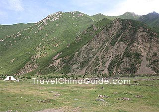
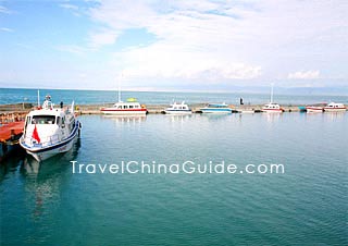
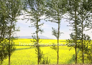
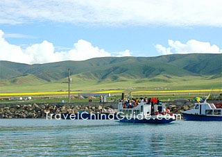
Hainan Tibetan Autonomous Prefecture is seated in the southeast region of Qinghai Province in the neighborhood of Haidong, Xining and Huangnan to the east, Haixi to the west and Golog to the south. In the north, it is separated from Haibei by Qinghai Lake. Hainan is covered by mountains, rivers, lakes and grasslands. Qinghai Lake, the largest inland lake in China, is located in Hainan. From April to June every year, Qinghai Lake is an ideal place to watch hundreds of thousands of migrant birds. But July and August are the best time to visit Qinghai Lake when a large scale of rapeseed flowers are fully bloomy. The annual cycling race around the lake is also held at that time.
Hainan Attractions - Things to Do
Qinghai Lake, Qiabuqia Town and Guide County are the three main scenic areas of Hainan Prefecture. It is the largest salt lake in China situated between Haibei and Hainan prefectures. Longyangxia Hydropower Station is the first large-scale cascade hydroelectric power station on the upper reaches of the Yellow River. Around the dam area and Qiabuqia Town, there are also several scenic spots and holiday resorts. Guide County has many historic relics, such as Yuhuang Pavilion, Nanhai Hall and Zhenzhu (Pearl) Temple. On the boundary area between Gonghe County and Huangyuan County of Xining, the Riyue Mountain is the inevitable pass to the Qinghai-Tibet Plateau.![]() Other Scenic Spots: Zhacang Hot Spring, Danxia Geomorphology in Ashigong Canyon
Other Scenic Spots: Zhacang Hot Spring, Danxia Geomorphology in Ashigong Canyon
|
|
How to Get to Hainan
Daotanghe Town is a vital stop on these two highways. It is beside the Daotang (Backflowing) River of Riyue Mountain. Departing from the town, Qinghai-Tibet Highway stretches westward to contact with Haixi Mongol and Tibetan Autonomous Prefecture, while the Qingkang Highway runs to the southwest and gets to Guoluo and Yushu Tibetan autonomous counties.
Bus station in Gonghe County is located at 9, Lüzhou Nan Lu. Furthermore, each county has its own bus stations in the county seat.
|
|
Weather
The prefecture bears a continental plateau climate, featuring rarefied atmosphere, insufficient precipitation, long daylight hours and great temperature variation during a day and small temperate difference during a year. Hainan weather is dry and windy in spring, rainy and dank in autumn. Summer is short and cool, while winter is long and chilly. May to September is the beat time to visit this Prefecture.
Hainan Travel Tips
![]() History: Before the Western Han Dynasty (206BC-24AD) brought this area into the domain of the central government, Hainan Prefecture was inhabited by the Qiang and Rong nationalities which were all ancient tribes in western China. In 1953, Hainan Tibetan Autonomous Region was established and changed to the Hainan Tibetan Autonomous Prefecture two years later.
History: Before the Western Han Dynasty (206BC-24AD) brought this area into the domain of the central government, Hainan Prefecture was inhabited by the Qiang and Rong nationalities which were all ancient tribes in western China. In 1953, Hainan Tibetan Autonomous Region was established and changed to the Hainan Tibetan Autonomous Prefecture two years later. ![]() Physical Features: Lying in the Gonghe Basin, Qinghai Lake Basin and the Yellow River Valley, Hainan is lower in the center and higher in fringe area and the terrain slopes generally downward from the southwest to the northeast.
Physical Features: Lying in the Gonghe Basin, Qinghai Lake Basin and the Yellow River Valley, Hainan is lower in the center and higher in fringe area and the terrain slopes generally downward from the southwest to the northeast.![]() Special Local Products: Located in plateau area, unique climatic and physical features make some rare and precious Chinese medical herbs of perfect quality, such as snow lotus, Chinese caterpillar fungus, fritillary bulb and deer antler. Visitors should be cautious to identify if the Tibetan herbs on sale are real or false. Additionally, long-stalk pear and chang are all distinctive local products.
Special Local Products: Located in plateau area, unique climatic and physical features make some rare and precious Chinese medical herbs of perfect quality, such as snow lotus, Chinese caterpillar fungus, fritillary bulb and deer antler. Visitors should be cautious to identify if the Tibetan herbs on sale are real or false. Additionally, long-stalk pear and chang are all distinctive local products.


