Pingliang Travel Guide
Pingliang Facts
Chinese Name: 平凉市 (píng liáng shì)
Population: 2,119,100
Area: 11, 000 square kilometers (4,247 square miles)
Location: in the east of Gansu Province, northwestern China
Administrative Division: 1 district (Kongtong); 6 counties (Jingchuan, Lingtai, Chongxin, Huating, Zhuanglang, Jingning); 1 industrial park (Pingliang industrial park)
Area Code: 09333
Zip Code: 744000
GDP (2017): CNY 39.52 billion (USD 5.97 billion)
One of the 50 Most Mesmerizing Places in China
Standing in the east of Gansu Province, Pingliang neighbors Ningxia Hui Autonomous Region to the north and Shaanxi Province to the south and east, being an important pass linking the inner Gansu with the east region of China. The geographical advantage and convenient transportation enable Longnan to become an important trade and regional center city. It is also the main production base of agricultural and forestry products in Gansu Province and a big animal husbandry base in the northwest regions. It is said Pingliang is dubbed as one of the 50 most mesmerizing places in China by foreigners where more than 100 scenic spots are dotted. Among them, The Kongtong Mountain is the most famous mountain embodying the Taoist culture.
Pingliang Attractions - Things to Do
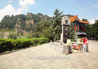
Kongtong Mountain is a branch of the Liupan Mountains, 12 kilometers (7.5 miles) west of Pingliang city proper. It was a mountain resort that combining the beauty of natural and historic landscapes. It was not only the ancestral mountain of Taoism, but also a religious site with coexistence of Taoism, Buddhism and Confucianism for over 1,500 years. It is endowed with typical Danxia Landform with strange rocks and caves scattered all over the mountain. Historic tracks and masterpieces by nature left in the mountain make it a famous national scenic area.
|
|
Other Scenic Spots: Willow Lake Park, Queen Mother Palace Grottoes, Longquan Temple, Wulongshan Scenic Area, Yunya Temple Forest Park
How to get to Pingliang from Lanzhou
Pingliang is about 350 kilometers (217 miles) from Lanzhou, and there are several buses in the bus stations daily shuttling between the two cities. The city has two principal bus stations. The west station is located in Gonglu Street, offering special line buses to the Kongtong Mountain. The east station is in No.68, Jiefang Road (North).
Weather
![]() When to Go: in spring and autumn
When to Go: in spring and autumn
Pingliang Travel Tips
![]() History: It was one of the headstreams of Chinese civilization that was inhabited by human ancestors 200-300 thousand years ago. As early as 3,000 years ago, cultivation culture had been created in this area. In the year of 358, the name of Pingliang was first used for a shire.
History: It was one of the headstreams of Chinese civilization that was inhabited by human ancestors 200-300 thousand years ago. As early as 3,000 years ago, cultivation culture had been created in this area. In the year of 358, the name of Pingliang was first used for a shire.![]() Physical Features: Pingliang is located in the hill and ravine region on Loess Plateau having rivers, valleys, mountains, plains and tablelands. Decumbence of the Liupan Mountain parts the city into the east dry and mountainous region and the east ravine area within the drainage area of the Jinghe River.
Physical Features: Pingliang is located in the hill and ravine region on Loess Plateau having rivers, valleys, mountains, plains and tablelands. Decumbence of the Liupan Mountain parts the city into the east dry and mountainous region and the east ravine area within the drainage area of the Jinghe River.![]() Special Local Products: apple, walnut
Special Local Products: apple, walnut

